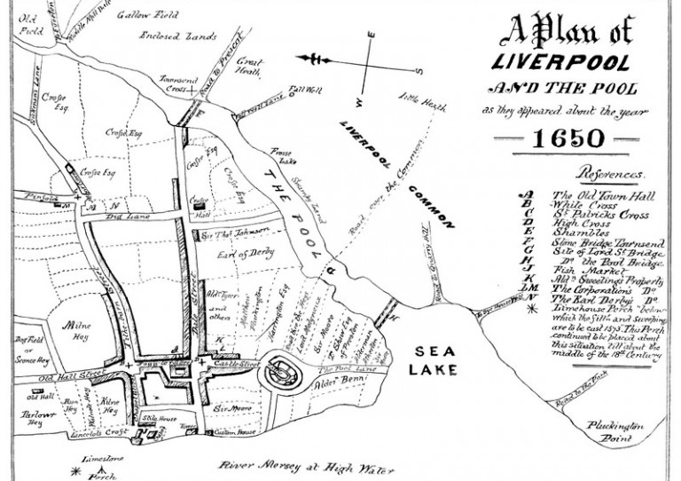
Plan of Liverpool around 1650. The inlet from the Mersey to the Pool is clearly depicted, along with the original streets, such as Dale Street, leading to the main route in and out of town across the Townsend stone bridge towards Prescot. The castle is also clearly shown, while the key on the right refers to the Town Hall and St Patrick's Cross, which reputedly marks the spot where St Patrick gave a sermon before heading on his mission to Ireland. Also of interest are the various plots, or burgages, illustrated with the names of the owners.


